While Sentinel Peak, also called “A” Mountain, isn’t the highest place around, it’s tall enough (2900 feet elevation) to provide a bird’s eye view of Tucson and the mountain ranges that encircle this City in the heart of the Santa Cruz Valley. (The view at the top of this post is looking westward from the top of “A” mountain.)
I’d heard an announcement from the city Park Dept. that as of Monday, Sept. 13th, the road that winds to the top of the Sentinel Peak Park would be closed to cars for a couple of weeks. The plan, the Park spokesperson said, was to repair the big University of Arizona “A” at the top. Some neighbors in the area seemed suspicious of this explanation, suggesting that the long term goal was to close the area to cars altogether. Time will tell…but I doubt that permanently banning cars and motorcycles will really happen. Too many people would complain.
But–I thought–maybe I should drive to the top and take photos now just in case a car ban is really in the works. (Hiking to the top wasn’t on any to-do list of mine.)
Surprises all the way up
While I have seen “A” Mountain — you can’t miss it–from below, it always looked pretty drab: just more creosote and other desert bushes with the big blue A” up top. Not even a lot of saguaros visible.


The blue “A” on the left is how it currently is painted; on the right is a previous version of the big “A”. The “A”, constructed of steel and concrete, was installed in 1938.
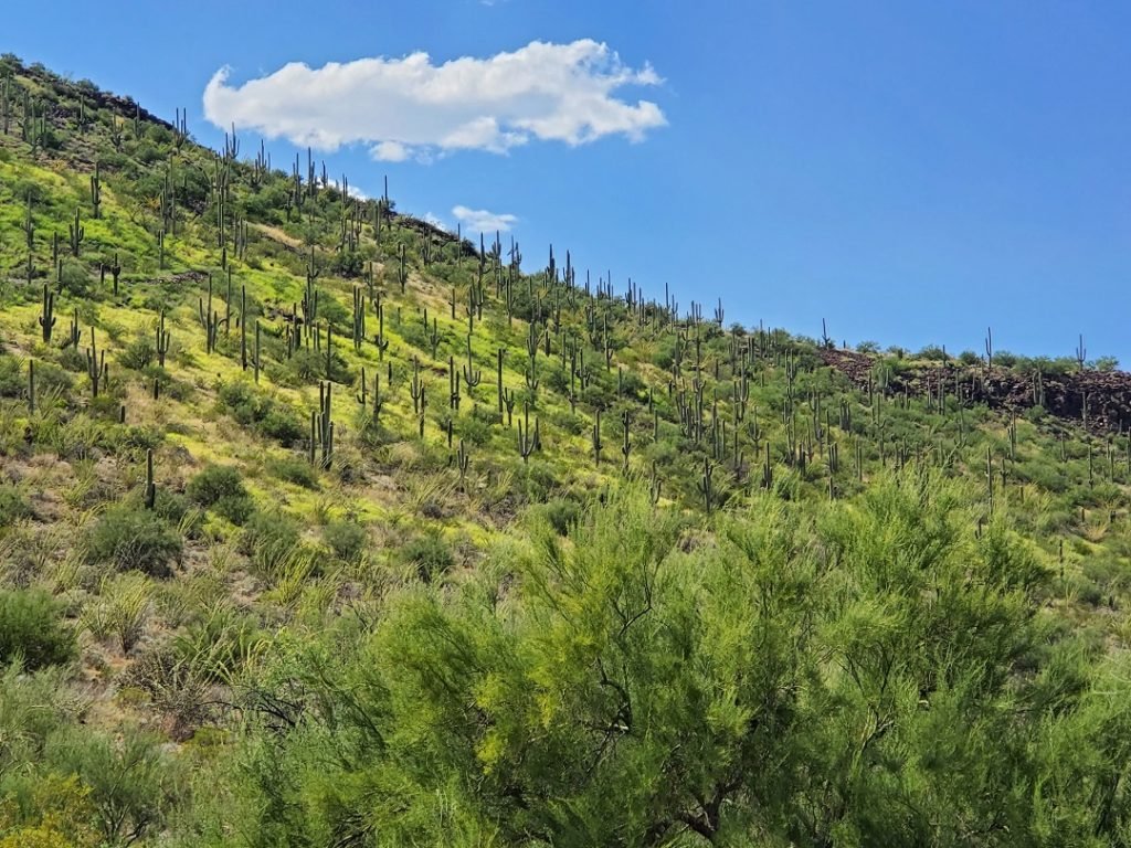
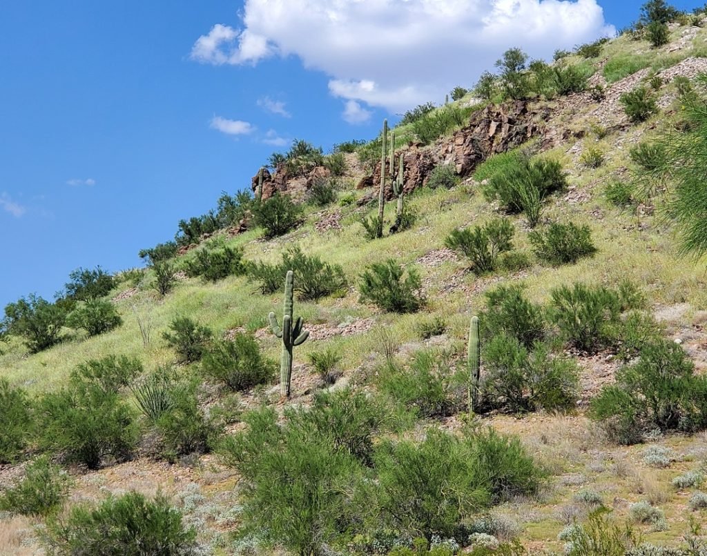
But I discovered that as well as having amazing views, it is quite a beautiful park. This photo, below, was taken at a parking lot about half way up the peak on the back side. Part of the beauty of this hillside is the result of the very wet monsoon Tucson has experienced this year. Suddenly everything is green! And there seemed to be more saguaros here than out at the Saguaro National Park.
And another view from half way up the mountain.
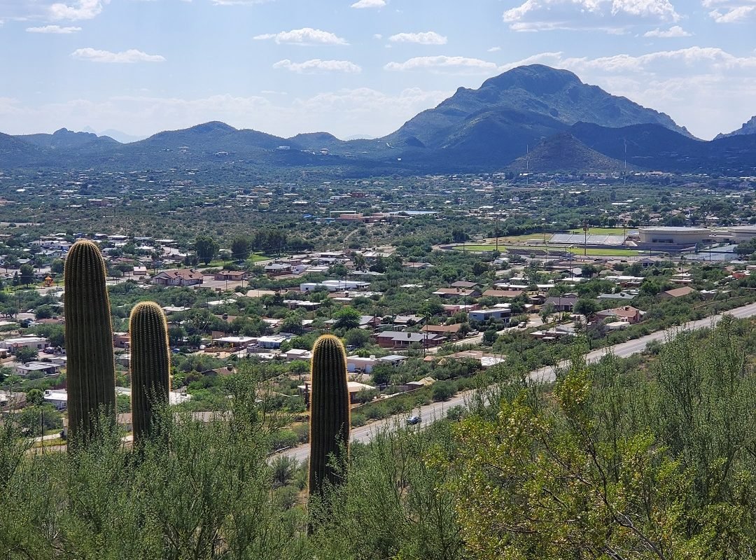
But it turned out there was one big problem: there are No Parking signs all along the section of the road at the top with the best views of the city. I decided not to be a parking scofflaw and continued on to the parking lot around on the back side of the peak. From the parking lot, however, it is a relatively short hike to the top. A hike I didn’t do because of the heat. Instead, I took photos from the parking lot. The one, below, is looking southeast.
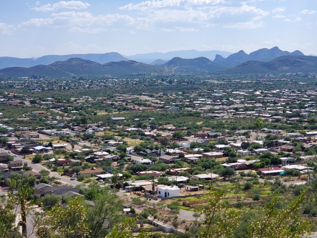
What struck me were the rings of mountains around the city plus how much larger Tucson is than I realized. This is a whole new area for me to explore!
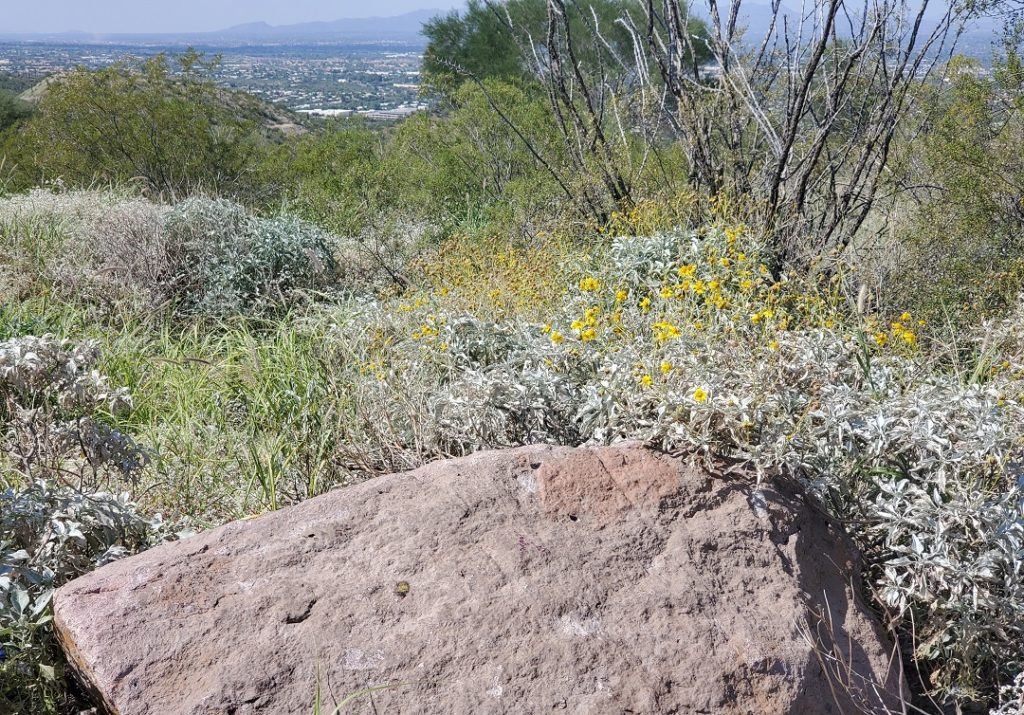
Also surprising: the sage and creosote and other native plants lining the parking lot were incredibly fragrant. I’d read descriptions of how intense the creosote and sage scents were, but this was the first time I’d experienced it.
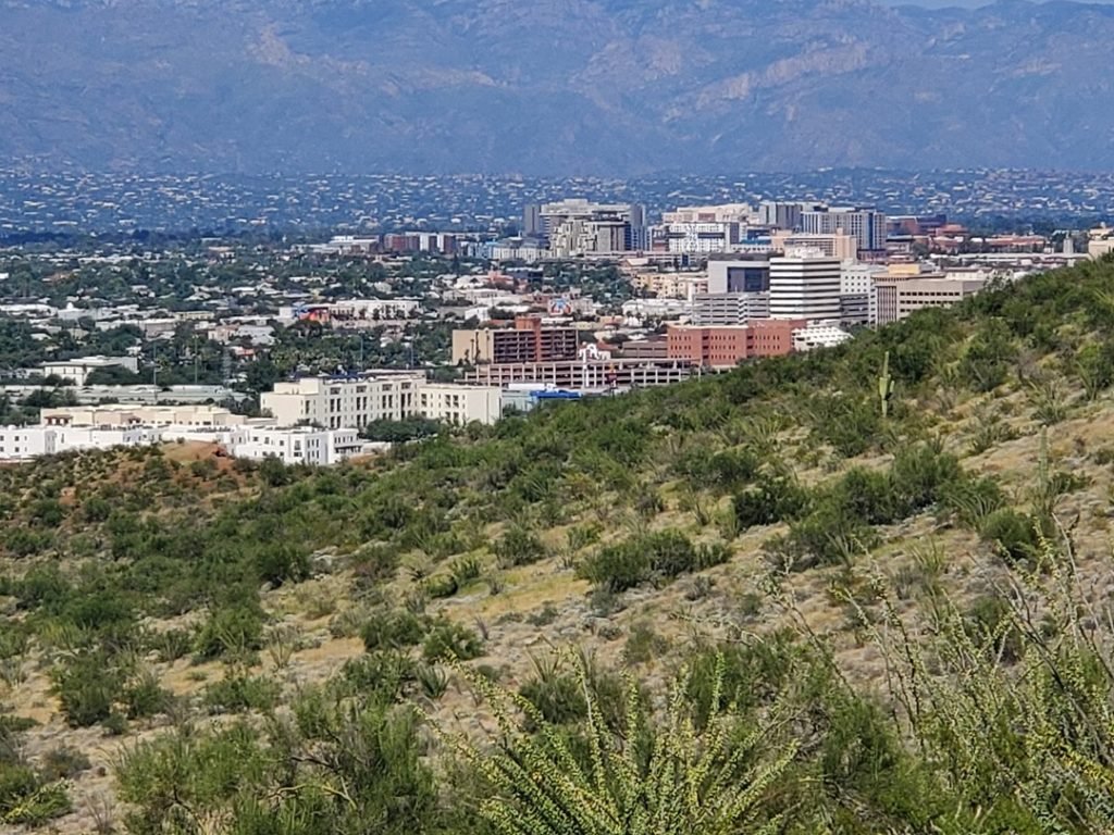
On my way back down the road I stopped again to take a photo of downtown Tucson. Or at least part of downtown Tucson with the Santa Catalina Mountains in the background. Most of the tall buildings are on the University of Arizona Campus. Tucson overall is basically a one story city.
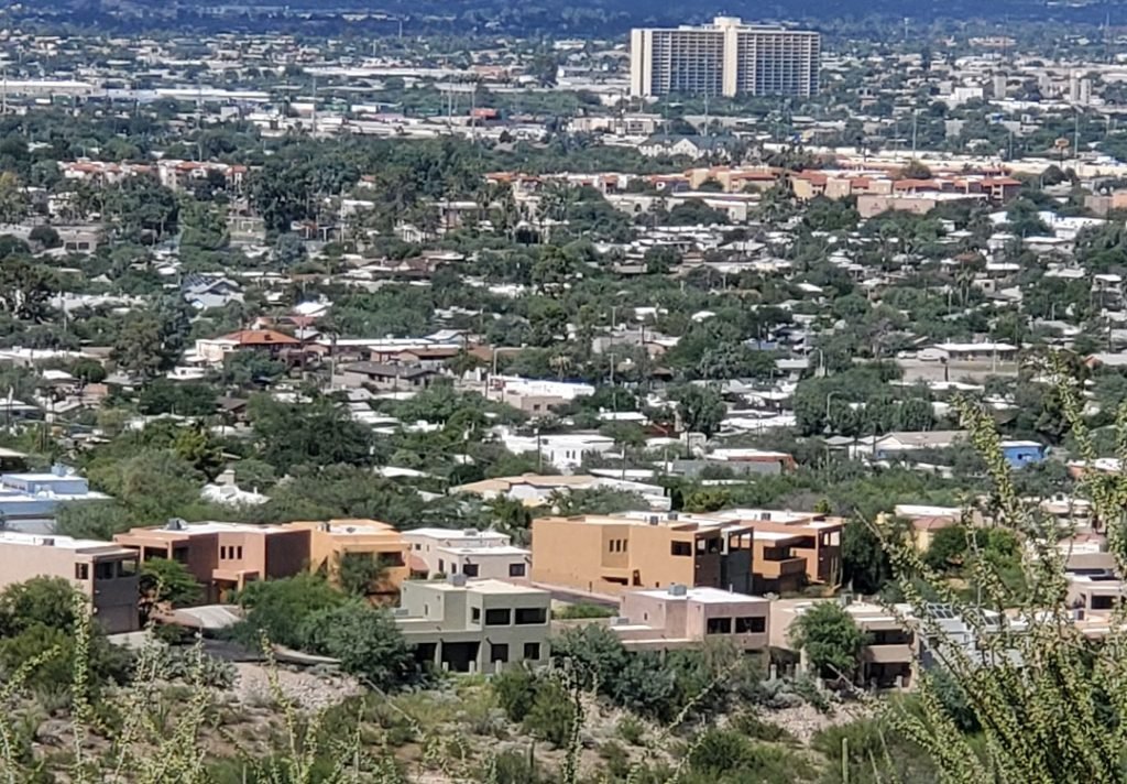
Looking northeast, the road winds around past some new upscale housing, below, near the exit from the park. The tall building in the distance is, I believe, what was once an luxury apartment building, but now is used as public housing by the City of Tucson.

According to the park website the road to the top of Sentinel Peak will re-open September 28th, 2021 but the hours will change. Check the site before you go.
Before you go, sign up to receive a free subscription to I Saw it In Tucson.
Never miss out on discoveries around the city.